• Home
    Page
  • Somercotes
    History
  • Industry &
    Business
  • Sport &
    Leisure
  • The
    War Years
  • Pubs &
    Taverns
  • Education &
    Religion
  • Miscellaneous
    Information
  • Photo
    Gallery
Photo Gallery
  • Photo Gallery Home
  • Photos By Location
  • Photos By Category
  • Photo Search
  • Full Photo List
  • Contribute Photos


Photo Search Results

Your Search Results Are Shown Below | Showing: Somercotes-Maps
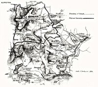


Alfreton Parish Map showing boundaries 1850 also shown are Nether Birchwood, Somercotes Common  and Alfreton Ironworks (Riddings Ironworks)
Alfreton & Somercotes Map (SLHS SM 004)
Click To View

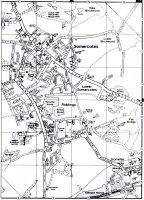
Street Map of Somercotes, Lower Somercotes & Riddings
Somercotes Street Map (SLHS SM 008)
Click To View

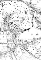
Map showing part of Riddings, Riddings House, Surrounding Land and Railway lines to the Ironworks
Somercotes Map (SLHS SM 009)
Click To View


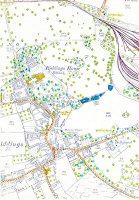
Visible top left the Railway lines to the Ironworks and Riddings House & surrounding land.
Riddings Map (SLHS SM 010)
Click To View

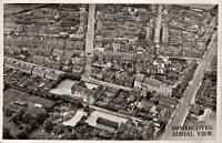
Somercotes Aerial View taken around the late 1940s
Somercotes Aerial View (SLHS SM 013)
Click To View

An aerial view of Somercotes showing Pennytown close to centre with the Pennytown Nature Reserve above. The land in the centre has now all been used for the industrial estates.
Somercotes Aerial View (SLHS SM 014)
Click To View


Showing Photos 7 to 12 of 12
Page 2 of 2 Pages
Web Site By OurSite.Info
© Somercotes History Society 2025
Validate: XHTML | CSS