• Home
    Page
  • Somercotes
    History
  • Industry &
    Business
  • Sport &
    Leisure
  • The
    War Years
  • Pubs &
    Taverns
  • Education &
    Religion
  • Miscellaneous
    Information
  • Photo
    Gallery
Photo Gallery
  • Photo Gallery Home
  • Photos By Location
  • Photos By Category
  • Photo Search
  • Full Photo List
  • Contribute Photos


Photo Search Results

Your Search Results Are Shown Below | Showing: Pye Bridge, Various
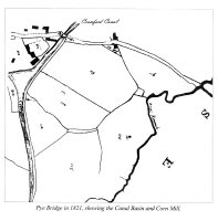


1821 Map of Pye Bridge shows the Canal Basin, river Erewash and Corn Mill
Somercotes Map (SLHS SM 035)
Click To View

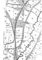
Map of Pye Bridge places of interest on the Map are both Railway Stations, Somercotes Junction and the Old House at Home Pub.
Pye BridgeMap (SLHS PBM 012)
Click To View


Showing Photos 37 to 38 of 38
Page 7 of 7 Pages
Web Site By OurSite.Info
© Somercotes History Society 2025
Validate: XHTML | CSS